
This Scientist Gave Astronauts a Map for Landing on the Moon

Saturday, July 20, is the 50th anniversary of the Apollo 11 space program’s landing on the moon. In honor of the achievement, Citizen Truth will run a series of articles about little known aspects of the Apollo 11 space program all week.
What happened when a noted astronomer asked for collaborators in 1955 to use telescopes to make a photographic map of the moon for NASA? Only one person raises his hand.
Englishman Ewen Whitaker answered Gerard Kuiper’s call and moved to the United States to work with him. The robotic spacecraft Surveyor 1 landed on the moon in 1966, and the NASA team reported where they thought they landed. Whitaker showed they were mistaken and using photos from the Kuiper lab showed NASA the astronauts actually landed a few miles away.
This may seem like a non-event, but later for Apollo 11, Whitaker’s work was crucial. To land at a precise location on the moon, NASA needed precision latitude and longitude data, and Whitaker’s work made that possible. NASA asked Whitaker to help choose the Apollo 12 landing spot based on where the new Surveyor 3 spacecraft landed. When Pete Conrad and Alan Bean walked on the lunar surface, they were within walking distance of Surveyor 3, although at first they couldn’t see it because it was in a shadow.
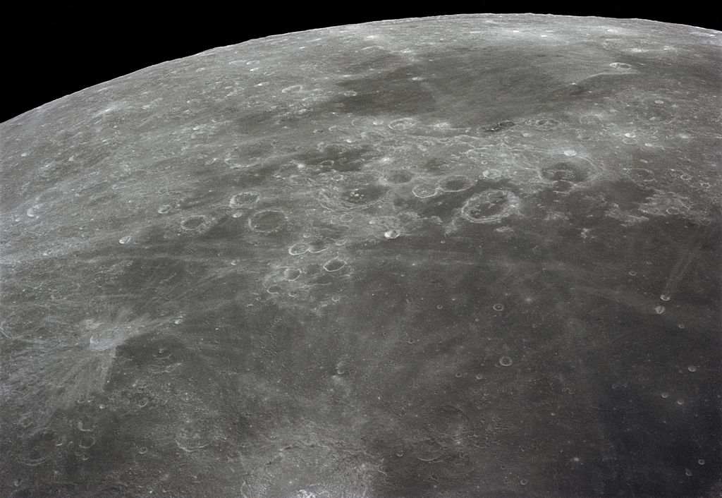
Hand-Drawn Maps of the Moon

Three members of the Ranger 7 television experiment team stand near a scale model and lunar globe. From left: Ewen Whitaker, Dr. Gerard Kuiper, and Ray Heacock. (Photo: NASA)
Before the Apollo program, all maps of the moon were hand-drawn, a fact that seems astonishing in the current age of computer technology. Noted astronomer Gerard Kuiper devised a project to use state-of-the-art telescopes to make a photographic atlas of the lunar surface, long before the Apollo program ever existed.
At the time, the astronomy community had a very ho-hum attitude toward the moon. They found the moon boring since its appearance never changed. Rather than using telescopes to look at the relatively close moon, Kuiper’s fellow astronomers wanted to use the new technology to look at distant objects. His fellow astronomers were quick to also tell Kuiper that making these sorts of maps were a geologist’s job.
Kuiper ignored his colleagues and set up his small moon mapping project at the University of Arizona in Tucson. A year later, President John F. Kennedy made his famous speech regarding sending a man to the Moon and back safely.
Modern Imaging of the Moon
Suddenly, Kuiper’s lab, known as the Lunar and Planetary Laboratory was very important. He built special telescopes to create better lunar images. The Moon always keeps the same face toward the Earth, but images away from the center always appeared distorted, so they invented a novel way to view and photograph the surface features to correct for the distortion.
Over the years, the lab’s work created valuable scientific insight, like the discovery of Mare Orientale, a lunar basin that had very few impact craters, leading scientists to realize that it was a younger representation of what the other basins likely had been. Kuiper’s work on this crater helped establish the theory that the moon formed due to a giant impact on Earth, still the leading theory today regarding the origin of the moon.
Today, the Lunar and Planetary Laboratory still helps select landing sites. For more than 10 years, Kuiper’s lab has helped use high-resolution images to select landing sites on Mars.